Waste Pollution
We must concede that the modeling of zones susceptible to waste
pollution hazard was arduous. Though the final approach adopted was not
completely satisfactory and necessitates scrutiny, the assumptions made and the
mechanisms developed were likely to provide results that are coincident to the
reality of waste, which is wide spread over the study area. This factor covers
more than 95% of the area and received the greatest weight in the EOW survey.
About half of the study area (53%) was found exposed to at least high risks,
which pinpoints to the severity of this issue and the challenge it poses to
decision makers particularly in a context of very dynamic demographic
variables, and in a setting of weak institutional capacity of management.
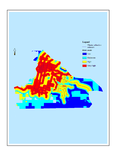
Figure 13 shows that neighborhoods away from the collection
network but having high density housing, and those very close to the network
but again with high density housing and located in lowlands were found to
exhibit the highest risk to waste pollution. Conversely people living in high
elevation and where the density of houses is relatively low enjoy a better
environment.

Figure 13: Waste Pollution
in Port-au-Prince
4.4.3 Housing Density
Housing density was deemed one of the most important factors,
which not only embodies a source of pollution and serves as sink for other
sources, but also underlines vulnerability to all the hazards considered.
Though concessions were made to classify some areas at low density where they
would be considered medium-to-high density by international standard
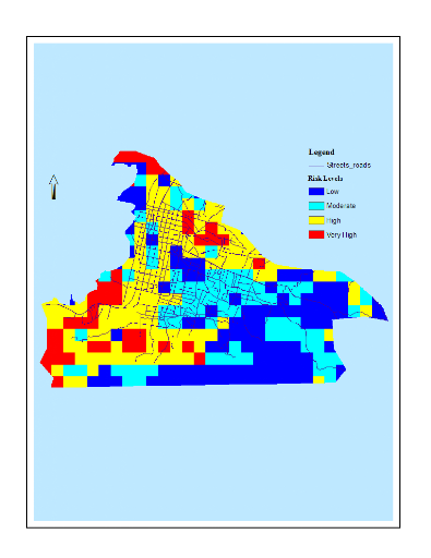
classification, about 46% of the areas were estimated to be high-to-extreme
density (Figure 14). However these densities are unique and incomparable to
those found in developed countries' urban neighborhoods. To illustrate this
sharp contrast, an average of 10,583 homes by square kilometer was counted in
Port-au-Prince by IHSI in the last national census (IHSI 2003). Even more
striking was the maximum density of more than 164,500 dwellings found in one
district. As a result the ventilation is very poor inside and outside these
structures; the distance between the toilets and the living spaces is
negligible, a situation that constantly exposes people to nearly physical
contact with feces and its manifestation; cooking with charcoal is done inside
or adjacent to the house; the effortless transmission of bacteria through
insects, rodents, and cockroaches and many other impacts for the physical and
the mental health.

Figure 14: Housing Density
in Port-au-prince
4.4.4 Pollution from Market Places
A common phenomenon that escapes authorities' control in the
study area is the extension of public markets beyond their original assigned
location. This expansion in Port-au-Prince resembles water run-off quickly
turning to overflows due to excess above the retention capacity. It has become
impossible to delimit the physical extents of the market places. In addition
to the official markets, there are the informal markets that have been accepted
as a fact. This study covered only those recognized by the city's
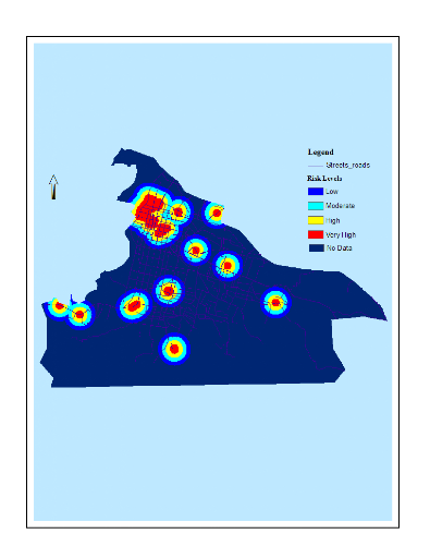
municipality. From low to very high, the hazards they represented formed more
than 22% of the area, of which about 36% (8% in total) where at high to very
high risk (Figure 15). The buffer built around the markets assumes that the
polluted air shed spreads homogeneously in all direction without consideration
of wind direction, transmission vectors traveling patterns, and obstacles in
the vicinity.

Figure 15: Pollution from
market places
| 


